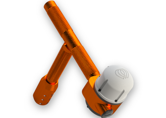
A first of its kind tool for geo-referencing seedlings planted in reforestation or carbon capture projects.
ARBORX
ARBORX
USER STORY #1: RANDY
Randy is the owner of a large forestry services company who employs 2000 seasonal migrant contract employees that plant trees every year. Randy’s company has really grown in size since he first started with two employees and it has become impossible for him to personally oversee all of the work being done by his teams. He attempts to visit and personally inspect all the work sites, but by the time he arrives on site his employees have already moved on to another job site that may be hours away. If a major problem is found, Randy must send one or more employees back to the job site to correct the mistakes which result in lost profits due to extra travel expenses and delaying the next job.
At a recent trade show, Randy found the OptiX ArborX devices which he decided to implement on his dibble bars. Now, Randy can monitor where his crews are throughout the day and at the end of each-day he can view full reports showing where his teams have planted trees. He is now able to instantly determine if problems exist and have his crews repair the issues before they leave the site which has saved him thousands of dollars and days of lost time.
USER STORY #2: ANDREA
Andrea is a timber landowner who employs various tree planting companies to come in and plant trees on her properties. In the past, she has paid survey companies to come out and locate all of the trees planted so that she can track the survivability of her trees and provide proof to her insurance company of the trees planted.
Andrea just learned about a new tree planting company who is using the OptiX ArborX devices on their dibble bars, so she hired them for her next forestation project. They were able to instantly provide her with maps showing the location of every tree planted which saved her the cost of hiring a survey company to come out for multiple days and she was able to determine that several acres had been planted at an incorrect spacing which would have reduced her profits. She was able to work with the tree planting company to correct the incorrectly spaced trees which increased her profit margins. Andrea was a happy customer, and the tree planting company was able to determine which planters incorrectly placed the trees and retrain them to do better work in future jobs.
Details and Specs
Create a gps address for the billions of seedlings planted each year to accurately calculate carbon offset volumes without guessing and validate each and every seedling as it goes into the ground, creating an unprecedented real-time auditing system for validating future fiber values.